Advisory flight display for the pilot monitoring
See the whole flight, not just the panel.
The nearest airports, terrain and traffic advisories, charts, approach plates and a WAAS-guided moving map, placed in the air around you. Live from the ADS-B receiver already in your aircraft, on Apple Vision Pro and iPad, and entirely self-contained once you leave the ground.
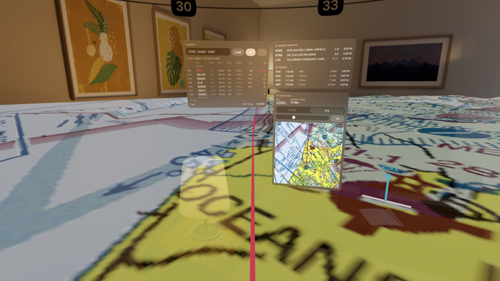
Always within reach
The nearest airports, one glance away.
Every field and navaid around you, ranked by live range and bearing, updating as you fly. Tap one and you have its frequencies in the order you will tune them, its runways, the current METAR with its age, and every published plate, without leaving the view outside.
Before ATC says a word
Terrain and traffic advisories, early.
A look ninety seconds down your track names the ridge or the tower ahead, how close and how soon. ADS-B traffic is placed in the air at its true bearing and height, and called out by clock position the moment it becomes a factor. You know before the frequency does.
Airports
Every field, in one tap.
Nearby airports and navaids follow you by distance and bearing. Search any field by identifier, name or city, or pick from the ones along your route.
Frequencies in the order you tune them.
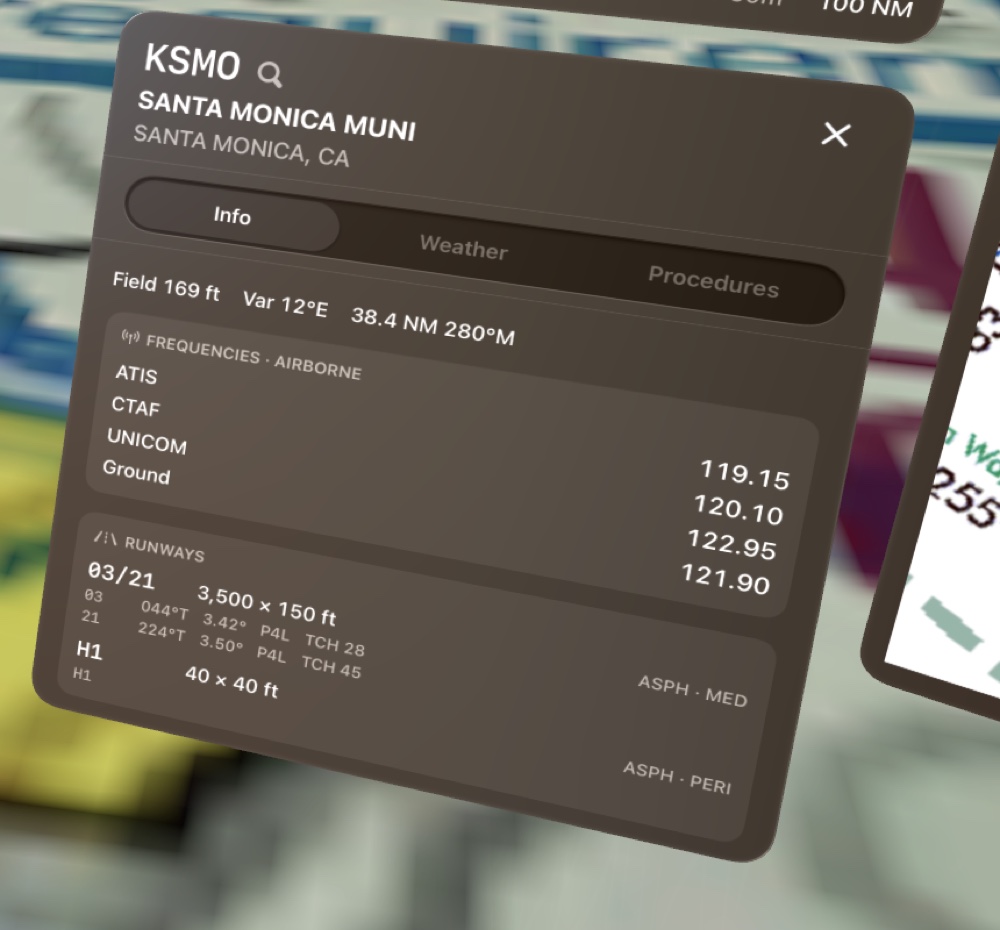
On the ground: weather, clearance, ground, tower. In the air: weather, then the tower or CTAF you are about to call. Runways with surface and dimensions, services, and the field's own procedures, each in its own inset so the eye lands where it should.
The Weather tab decodes the current METAR straight off the FIS-B broadcast and stamps it with its age, going amber when it is stale. The Procedures tab holds every departure, arrival and approach the field publishes.
- ATIS 119.15
- TWR 120.1
- GND 121.9
- METAR · 12 m ago
- Search · Recents · Along route
Terrain, obstacles & traffic
Advisories that arrive while there is still time to use them.
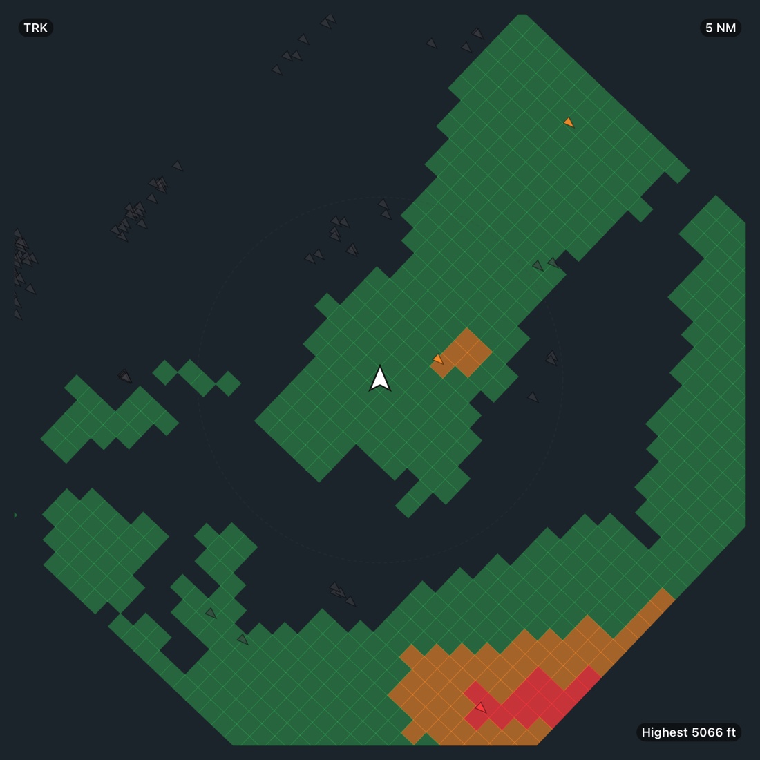
Height above ground and the highest terrain within ten miles sit on the ownship panel. Relief is shaded the way every terrain system shades it. Traffic is drawn where it actually is.
The ground ahead, before you get there.
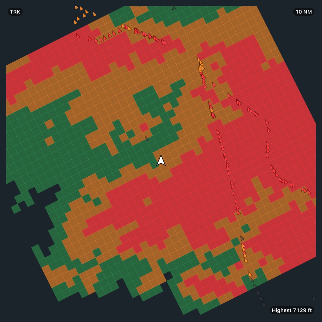
Terrain is colored red, amber and green by your clearance above it, with relief compressed as you climb so a high cruise reads as a map instead of a wall of peaks. A projected-path check looks a minute and a half down your track and raises an amber TERRAIN caution, red when it is close, with the distance and the seconds to it.
Every charted tower, stack and rig from the FAA obstacle file is on the map, colored by how far its top sits below you, and folded into the same look-ahead. A tower in the corridor raises the same advisory the ground does.
- AGL 1,240 ft
- Highest 3,189 ft within 10 NM
- OBSTACLE 370 ft in 63 s
- FAA DOF · daily
Traffic you can look up and find.
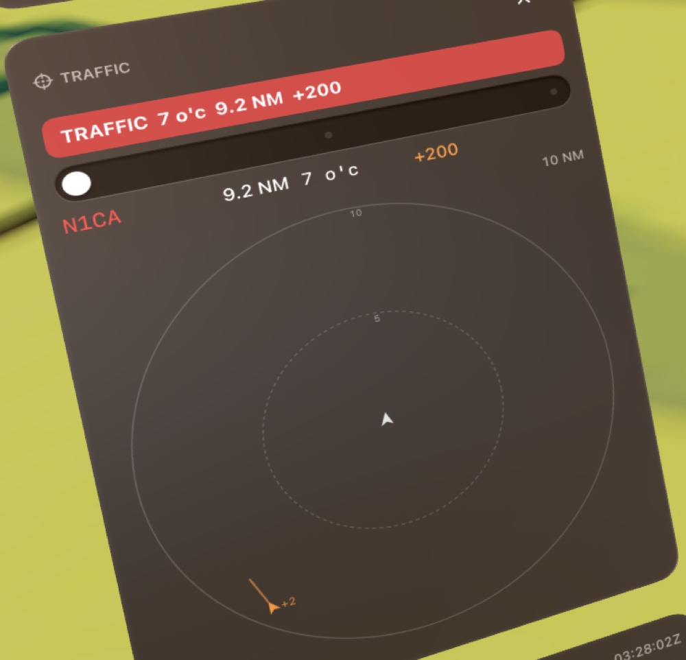
ADS-B contacts hang in space as rings at their true bearing and relative height, and plot on a nose-up scope with a one-minute velocity vector, pointing where each is actually going. When one becomes a factor (inside a mile and 600 feet, or predicted to pass within half a mile in the next 45 seconds), a red advisory names its clock position, range, height and whether it is closing.
It tells you where to look. It never tells you what to do.
- TRAFFIC · 7 o'clock · 9.2 NM · +200
- 3-D rings
- Traffic advisory, never a resolution
Towers on the chart, and in the warning.
Obstacles are drawn as small marks on the plan, grey when comfortably below you and amber as they close on your altitude, so the picture and the caution agree.
Charts & moving map
The charts you already know, draped on the ground you are flying over.
VFR sectionals and IFR enroute lows, both as the floor beneath you and in a moving map that turns to your track. Downloaded by state, stored on the device, and current to the FAA's cycle.
A moving map, drawn to scale.
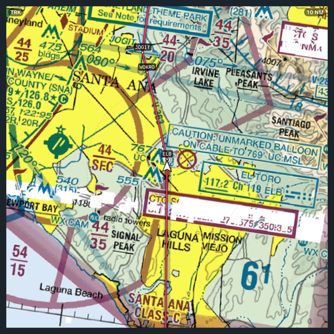
Switch the layer between terrain shading, the VFR sectional, the IFR low chart and NEXRAD weather. Step the range on detents, hold it track-up or north-up, and the ownship keeps pointing where you are actually going. The whole floor is the same chart, laid over real relief that sinks away as you climb.
- Terrain · VFR · IFR · WX
- 5 · 10 · 20 · 40 NM
- TRK · N↑
Every fix named, every altitude where the plate prints it.
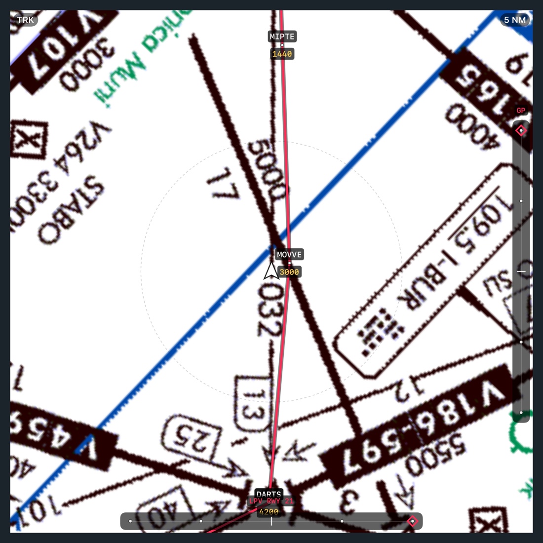
Fixes along your route are labelled on the map, and the fixes of a loaded approach carry their crossing altitudes exactly as the plate shows them: 3000 between DARTS and MOVVE, not a code to decipher. Labels stay upright as the map turns and clip to the range you have chosen, so a zoomed scope never clutters.
The missed approach is drawn as a thinner dashed line, so it can never be mistaken for the arrival.
Procedures & plates
From the plate on your knee to the fixes in your route, one tap.
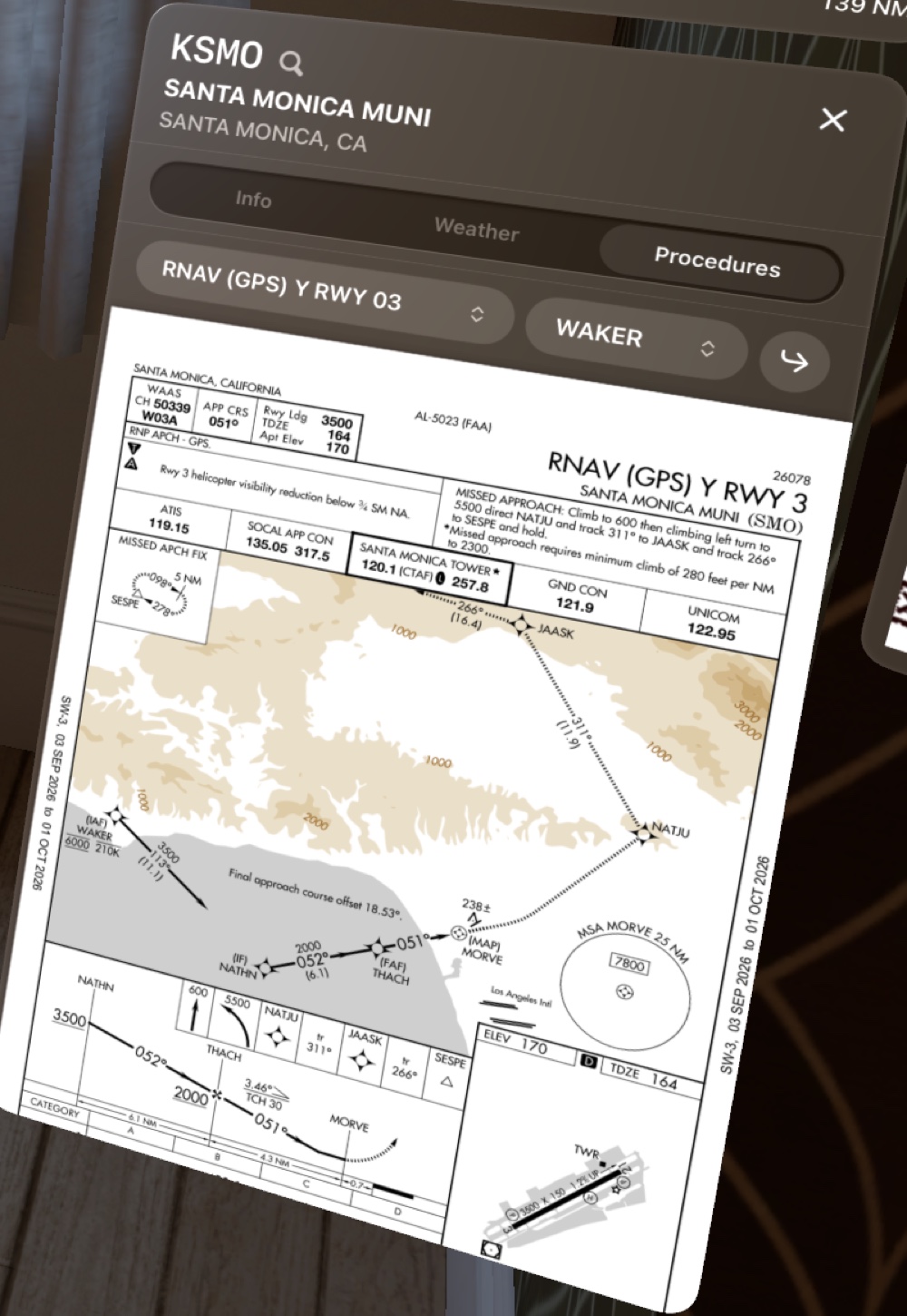
Every FAA terminal procedure, departures, arrivals and approaches alike, opens in the airport window, pinch-zoomed and dragged like paper. Pick the transition, and load it.
Load the approach you were just cleared for.
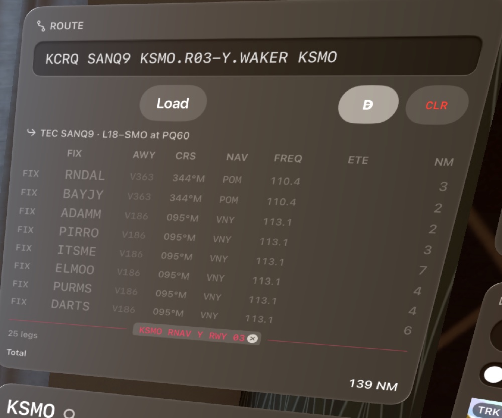
One row above the plate: the procedure, the transition or initial fix, and the arrow that loads it. A departure joins your route just after the origin; an arrival or approach just before the destination. Choose WAKER for the RNAV Y into Santa Monica and the route reads exactly as you would file it.
The approach ends at the missed approach point. The missed procedure follows the airport as its own segment, named as such, and kept out of your distance and time to destination, because it is a contingency, not the plan.
- KSMO.R03-Y.WAKER
- Departure · Arrival · Approach
- Transition / IAF
- · MISSED as its own segment
One token in the route, never a pile of fixes.
A loaded procedure lives in your route as a single entry, the way a TEC route does, so it can only be there once, it expands to its fixes when you need them, and it lifts out with one tap. GPS procedures read magenta; localizer and other ground-based procedures read green: the colors your needles already use.
WAAS approach guidance
Course and glidepath, exactly where the FAA codes them.
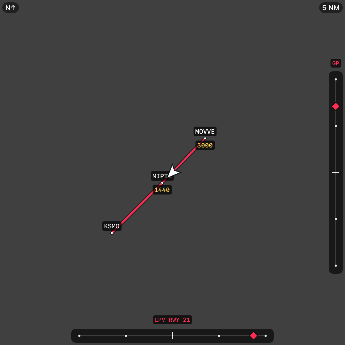
On an LPV final, the map's edges become a course tape and a glidepath tape with magenta diamonds, the same picture a G5 gives the pilot flying, in front of the pilot monitoring.
Built from the published final, nothing else.
Deviation is computed only from the FAA's coded WAAS final approach segment: the threshold, the alignment point, the course width, the glidepath angle and the crossing height, in the same WGS-84 frame your receiver reports altitude in. That segment exists only for LPV and LP approaches, so there is no glidepath for a localizer and none invented from a descent angle. LP gives you the course alone.
The tapes appear only while you are flying one of the approach's own legs, within fifteen miles of the runway and pointed at it, and they go hollow when pegged. Magenta, because this guidance is GPS.
- LPV RWY 21
- Diamond right → fly right
- Diamond above → fly up
- Never for LOC
Weather
The FIS-B picture, with its age on it.
NEXRAD over a range scope, METARs decoded at every field, and a timestamp on all of it. Nothing pretends to be fresher than it is.
Radar on the scope, METAR in the airport.
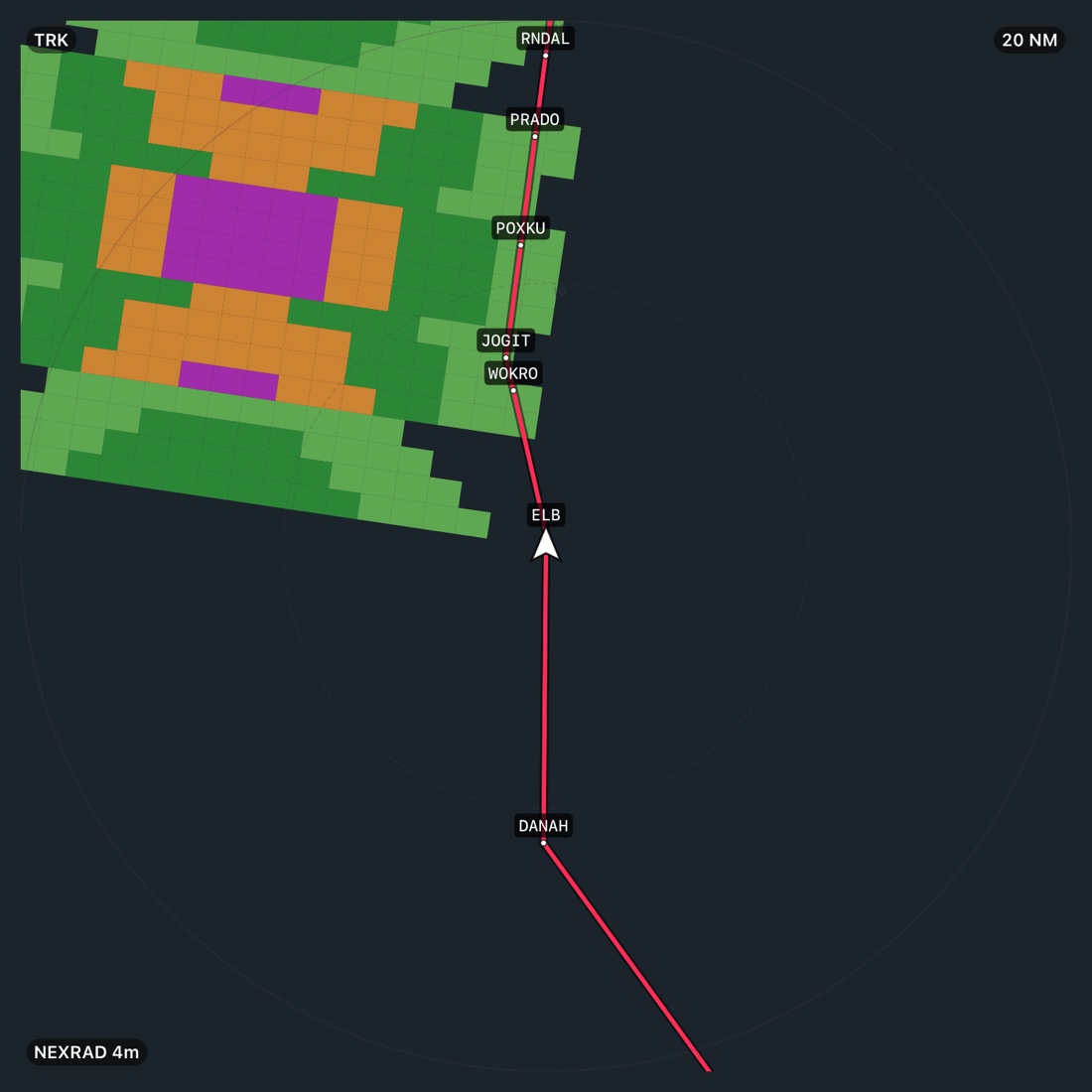
Switch the map to WX and the regional NEXRAD mosaic draws under your route with range rings and the minutes since the last frame. Open any airport and its METAR is decoded and stamped with the time it was issued, turning amber past an hour so an old report never reads as current.
- NEXRAD 4 m
- METAR · 53 m ago
- D-ATIS where broadcast
Routing
Type a clearance in, and fly it out.
The route box speaks pilot.
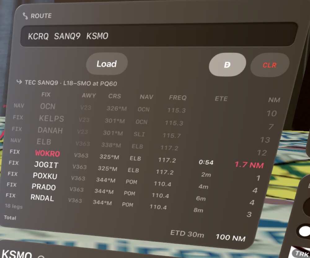
Airports, VORs, fixes, Victor and Jet airways, TEC routes and their designators, and published procedures, expanded into legs with magnetic courses, the navaid that provides guidance and its frequency, laid out in aligned columns. An identifier on an airway resolves to the navaid, not the airport that shares its name.
The leg being flown counts down in minutes and seconds; the ones beyond it in minutes. Go direct to any fix with one tap, or CLR and start over. Time and distance run to the destination, not past it.
- SANQ9 · L18 to SMO
- V23 / V363 / V186
- SLI 115.7 VORTAC
- Direct-to
- ETD to destination
Data
Everything on the device. Choose your states and forget it.
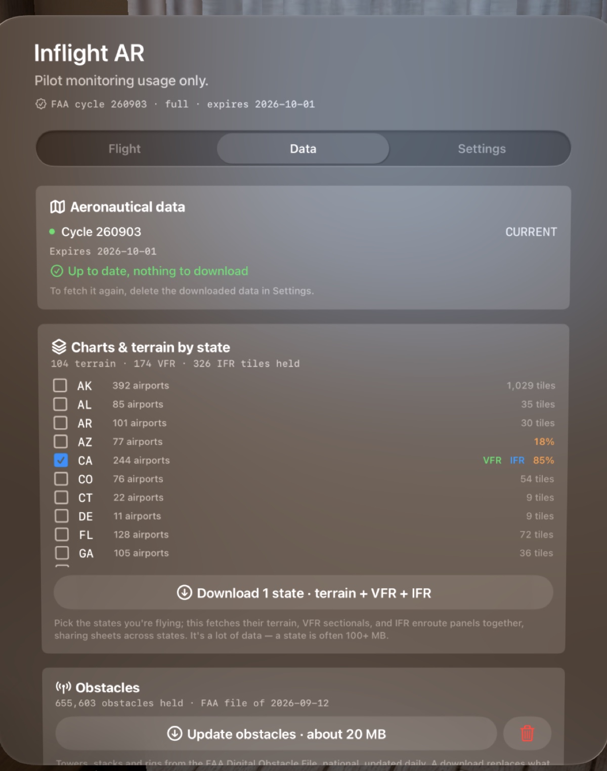
Pick the states you fly in and the charts and terrain for all of them download together, with progress per state. Your selection is remembered across updates. All of it lives in Files, works with no connection, and can be deleted when you want the space back.
- Charts & terrain, by stateVFR sectionals, IFR enroute lows and elevation tiles, downloaded as a setFAA · SRTM
- Terminal proceduresEvery departure, arrival and approach plate, by cycleFAA d-TPP
- Aeronautical dataAirports, navaids, fixes, airways, procedures with their legs, TEC routes, built on the device from the FAA's own filesFAA NASR + CIFP
- ObstaclesTowers, stacks and rigs, one national fileFAA DOF
Each dataset shows what is held and how current it is, and warns when a cycle has expired. Downloads run in the background, so the interface never waits on a file.
Two ways to fly it
Real flight and replay, told apart on purpose.
The same display serves the cockpit and the couch. Every live session records itself; any recording, or a track log from another app, replays through the same decoder as if the receiver were sending it now.
| Real flight | Replay | |
|---|---|---|
| Source | Live GDL 90 from your receiver over Wi-Fi | A saved recording, or an imported ForeFlight KML or GPX track |
| Floor map | More transparent, so the cockpit and controls stay visible through it | More solid, with no real panel beneath it |
| Map appears | Once properly airborne, never in the pattern | Low, for study on the ground |
| Indicated airspeed | Hidden: a receiver has no pitot | Shown, from the log |
| Pre-flight gate | Required before connecting; no bypass | Not required |
| Recording | Every session saved automatically | Pause, real time, 10×, 20×, and a scrub bar that replays everything up to the point you land on |
Built in, not written down
Safety by construction.
Inflight AR is for the pilot monitoring. It gives that pilot more than the panel can, and it is built so that it cannot be mistaken for the panel.
- Pilot monitoring usage onlyThe pilot in command flies the aircraft. The headset is worn by the pilot monitoring, who acknowledges a pre-flight gate before a live receiver connects. There is no in-flight bypass.
- Runs exclusivelyFlight mode is an immersive space; nothing else can be on screen while it runs. That is a property of the software, not a line in a manual.
- Advisories say where, never whatTerrain and traffic callouts name the threat, its position and its time. The display never commands a climb, a turn or a descent.
- Guidance only where the FAA codes itCourse and glidepath appear only on LPV and LP finals, from the published WAAS segment. Nothing is synthesised from a descent angle, and nothing is offered for a localizer.
- Clearly a displayIn real flight the floor map is drawn more transparent so the cockpit shows through it. Data currency is shown on every dataset and expired cycles are called out in red.
- No cameraThe app never uses the headset cameras. Nothing you see is a reconstruction of the world outside; it is data, placed where the data says.